Bird Counts
CAS undertakes two organized bird counts per year, in December and May; read on for more information on each.
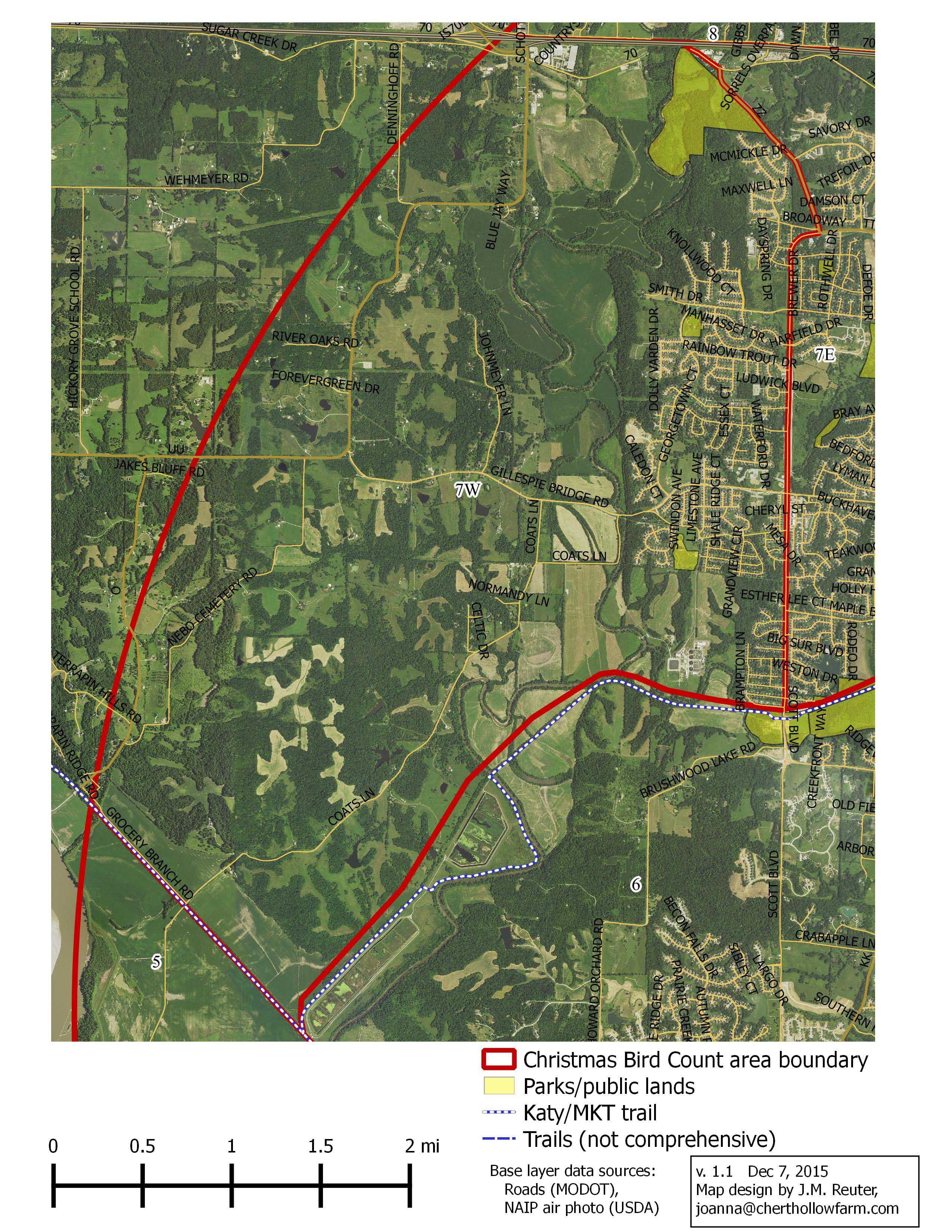
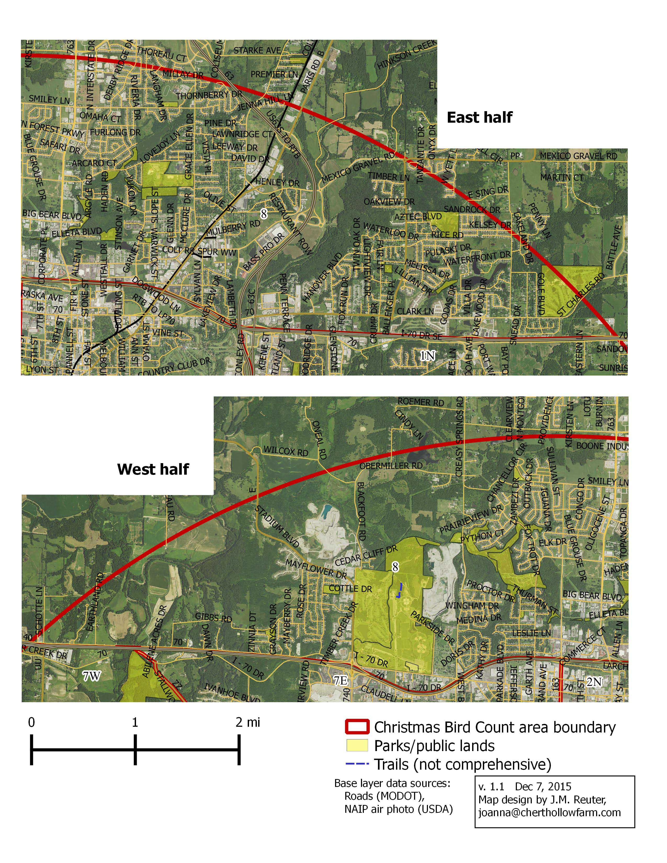
Christmas Bird Count
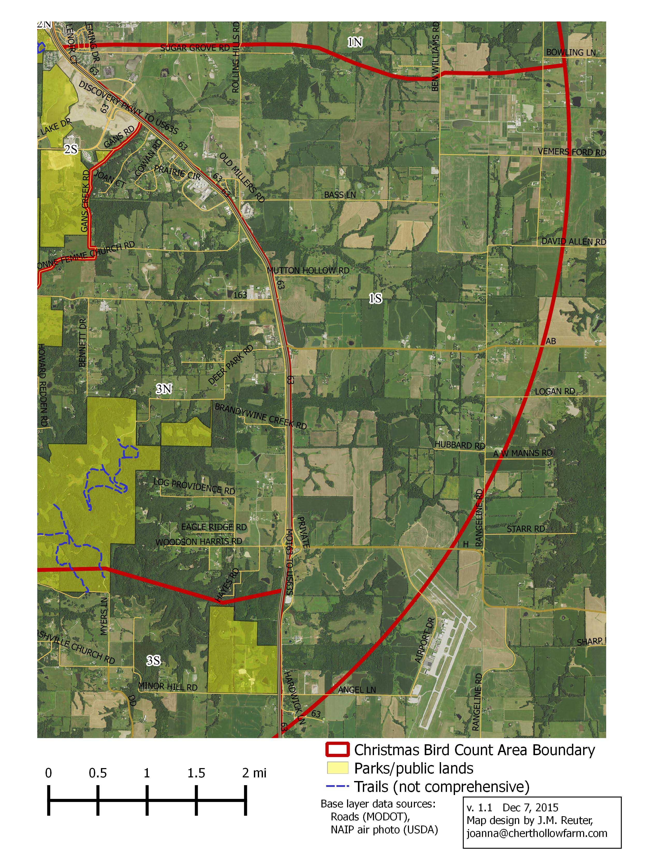
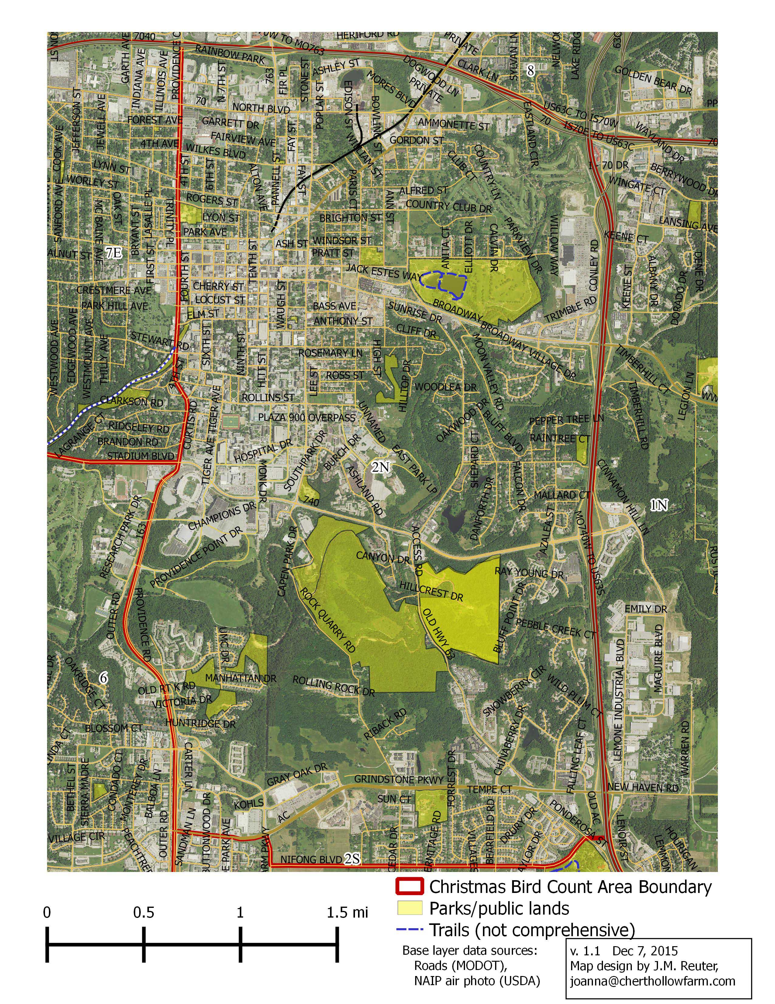
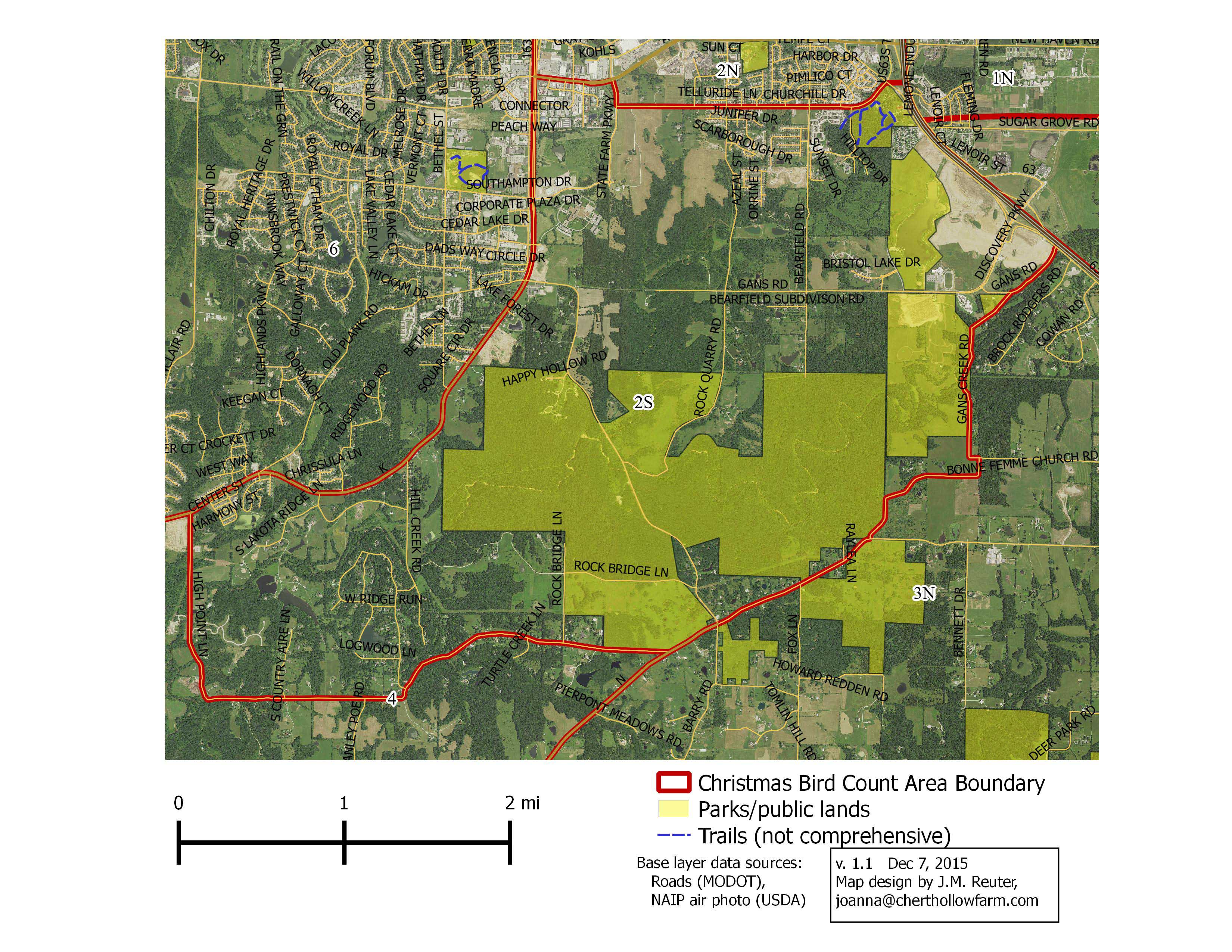
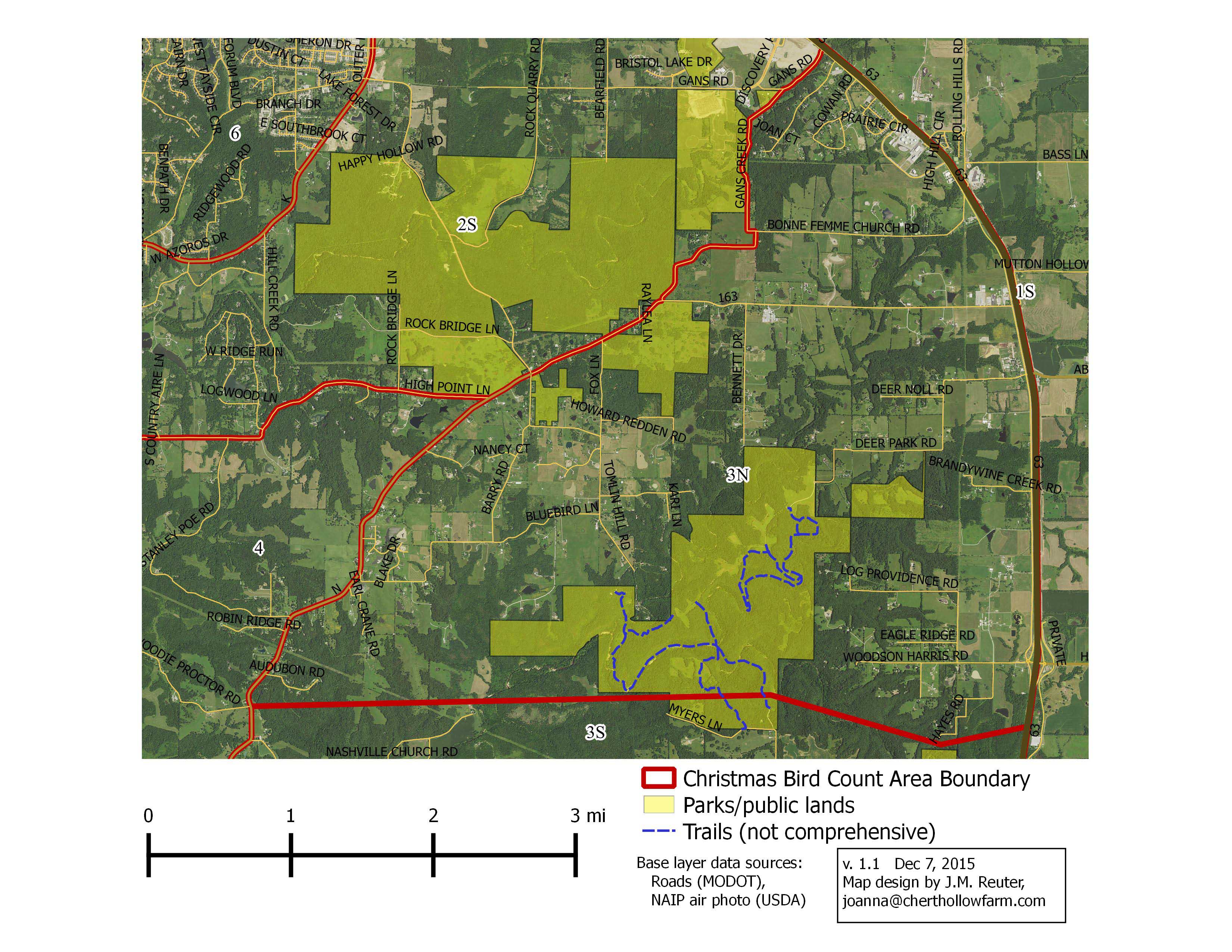
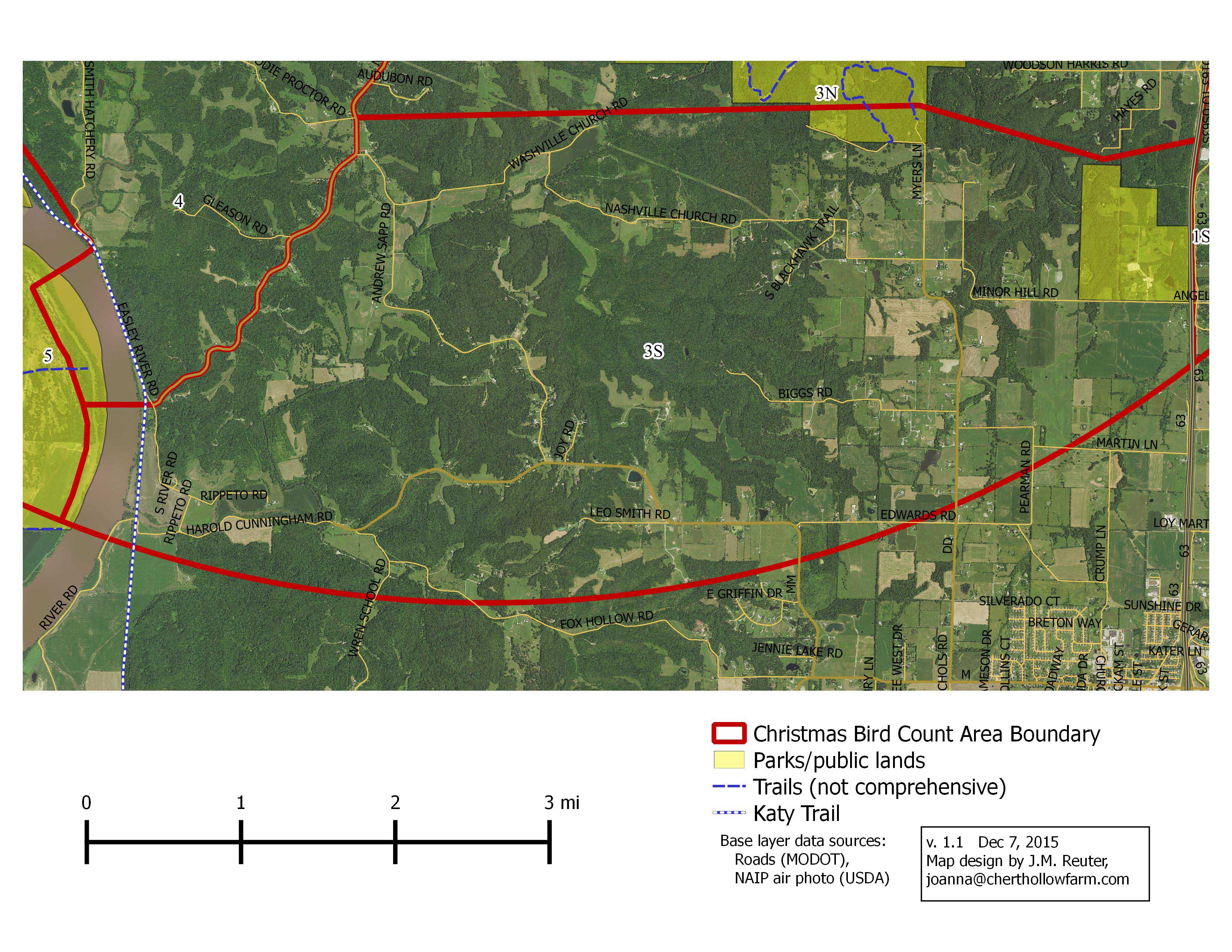
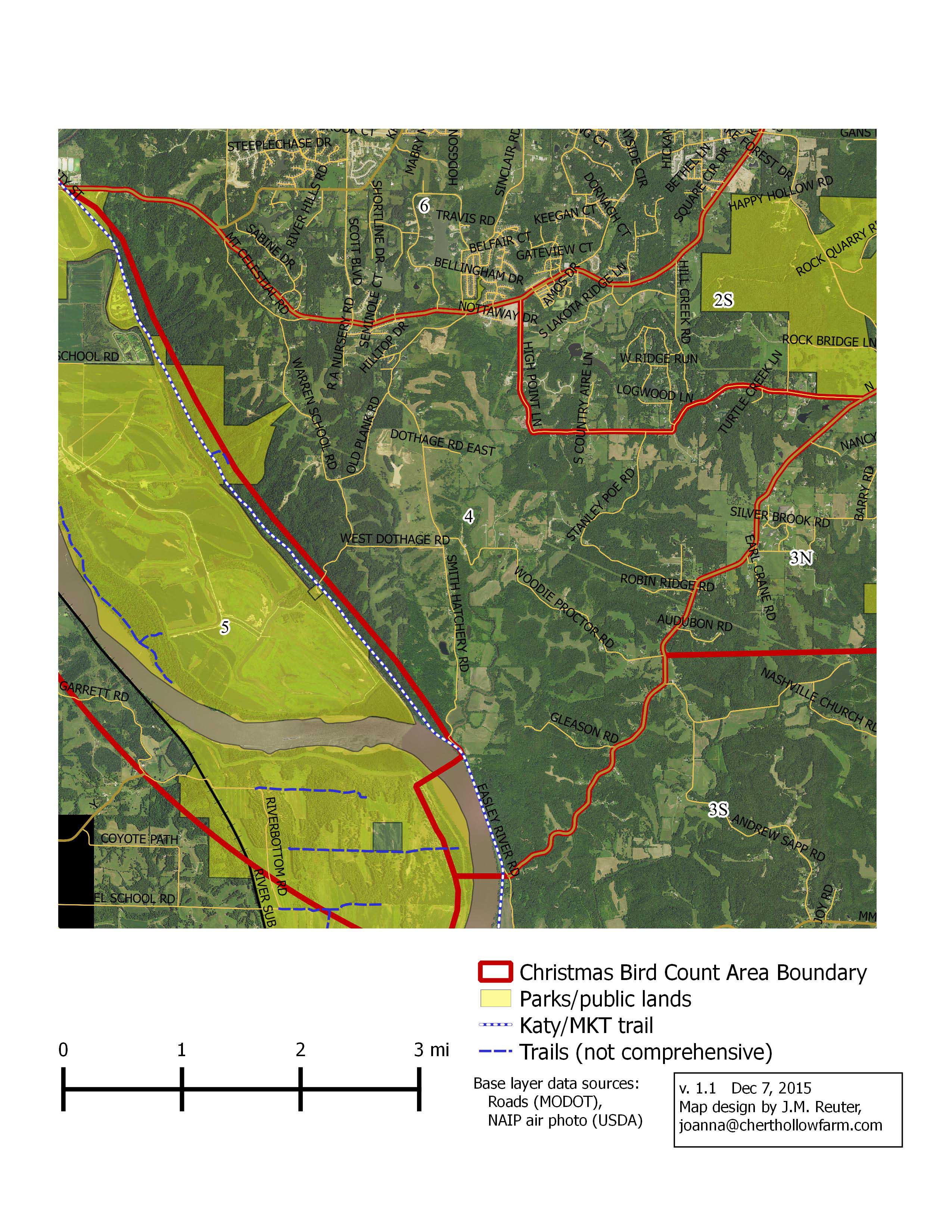
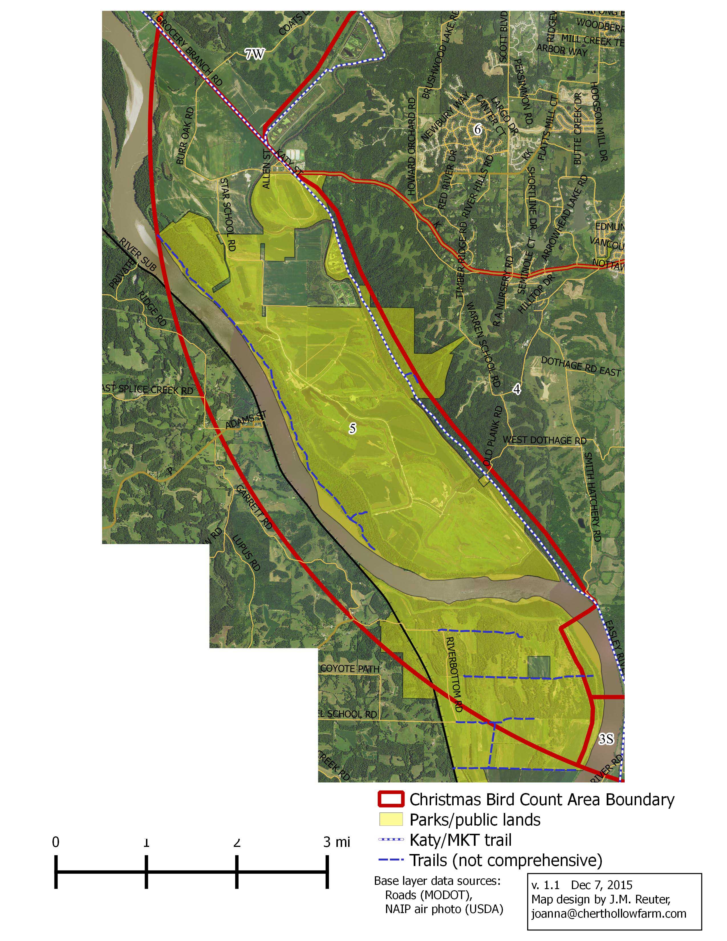
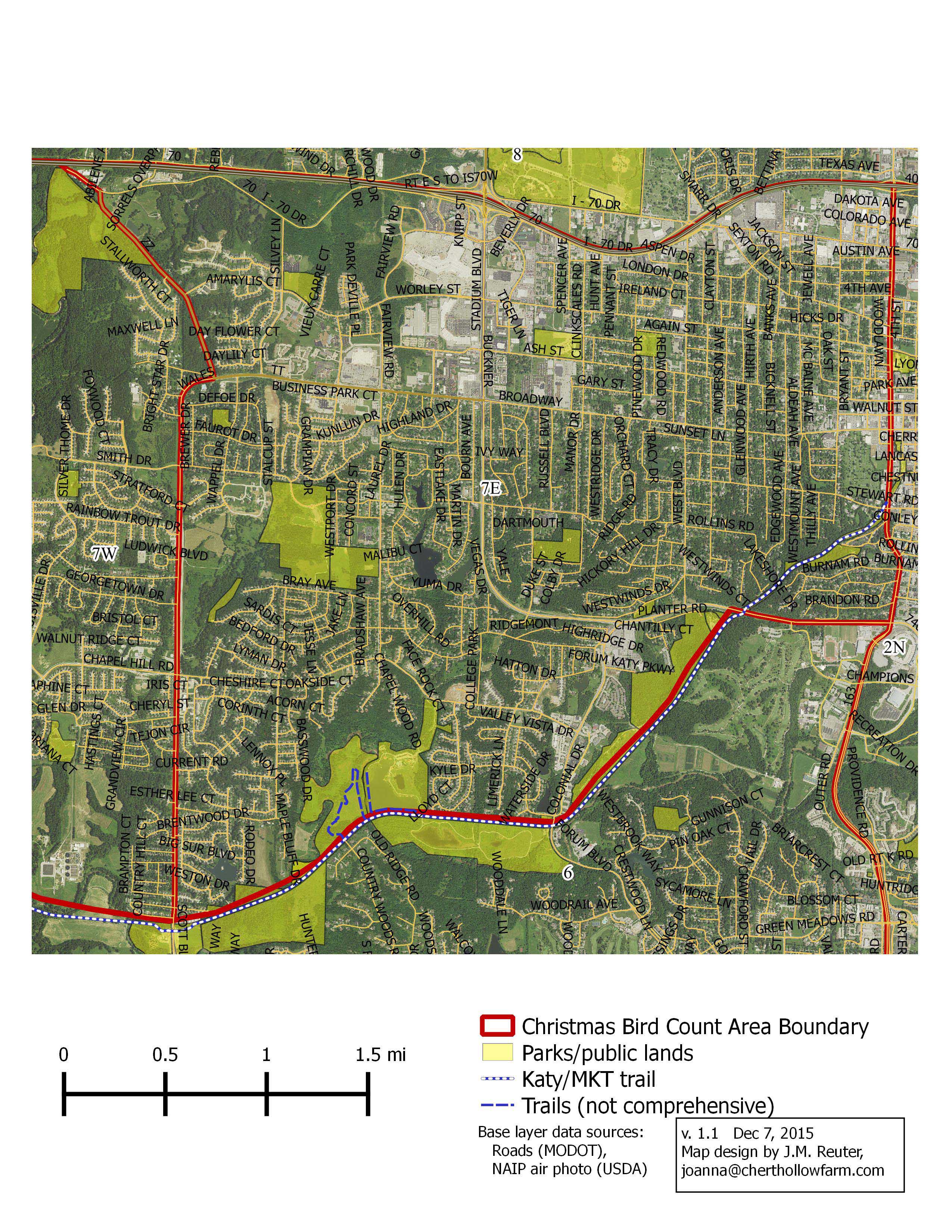
Conducted annually about December 15 in a 15-mile diameter circle around Rock Bridge Elementary School, the Columbia Christmas Bird Count (CBC) includes Missouri River bottoms, streams, woodland, prairie, and marsh. If you are interested in participating or would like more information, contact Laura Hillman at 573-442-3703 and leave a message.
Check out the National Audubon Society’s Christmas Bird Count web page and the count analyses by the Biological Resource Division of the U.S. Geological Survey (1959-1988). John Shipman, working with Zoological Data Processing, maintains a Christmas Bird Count database project.
CBC Count Area Maps:
• Interactive Google Map of CBC Count Areas (click an area to see its number)
• Printable Maps:
The CBC area maps come in two formats: one with a full aerial photo as background (JPG format, <2MB) and one with a more simple background suitable for black & white printing (PDF format, <200KB):
North American Migratory Count
The North American Migration Count (NAMC) was started in 1992 to give bird watchers the opportunity to enjoy a day’s birding during spring migration with the knowledge that the results of their findings, together with the birds counted by others, would reveal the status of bird migration on a specified date. The goals of the NAMC were to get a picture of the progress of spring migration, obtain data on the abundance and distribution of each migratory species, create more challenges and goals for birders, and (most importantly) to have fun.
For background on the original NAMC project, click here.
For several decades, Columbia Audubon Society has participated in the NAMC to assess the effects of winter habitat loss (cutting rain forests), migratory habitat loss (filling in wetland) and reproductive loss (cutting the Boreal forest). We know we have many species in serious decline. When the national NAMC stopped, Missouri continued and even though the state has now stopped, Columbia continues. We are in the process of putting current and prior data on line for anyone wishing to study “Columbia’s Birds”.
Each year, on the second Saturday of May, CAS organizes 13 teams covering all of Boone County. These are different areas and teams than the Christmas Bird Count which covers a circle centered in Rock Bridge State Park. If you are interested in participating or would like more information, contact Laura Hillman at 573-442-3703 and leave a message.
NAMC Count Area Maps:
• Interactive Google Map of NAMC Count Areas
• Printable Maps:
NAMC maps come in a single format (PDF, <2.2MB) with shaded-relief topography in the background:
| Area 1 | Area 2 | Area 3 |
| Area 4 | Area 5 | Area 6 |
| Area 7 | Area 8 | Area 9 |
| Area 10A | Area 10B | Area 10C |
| Area 11 | Area 12 | Area 13 |